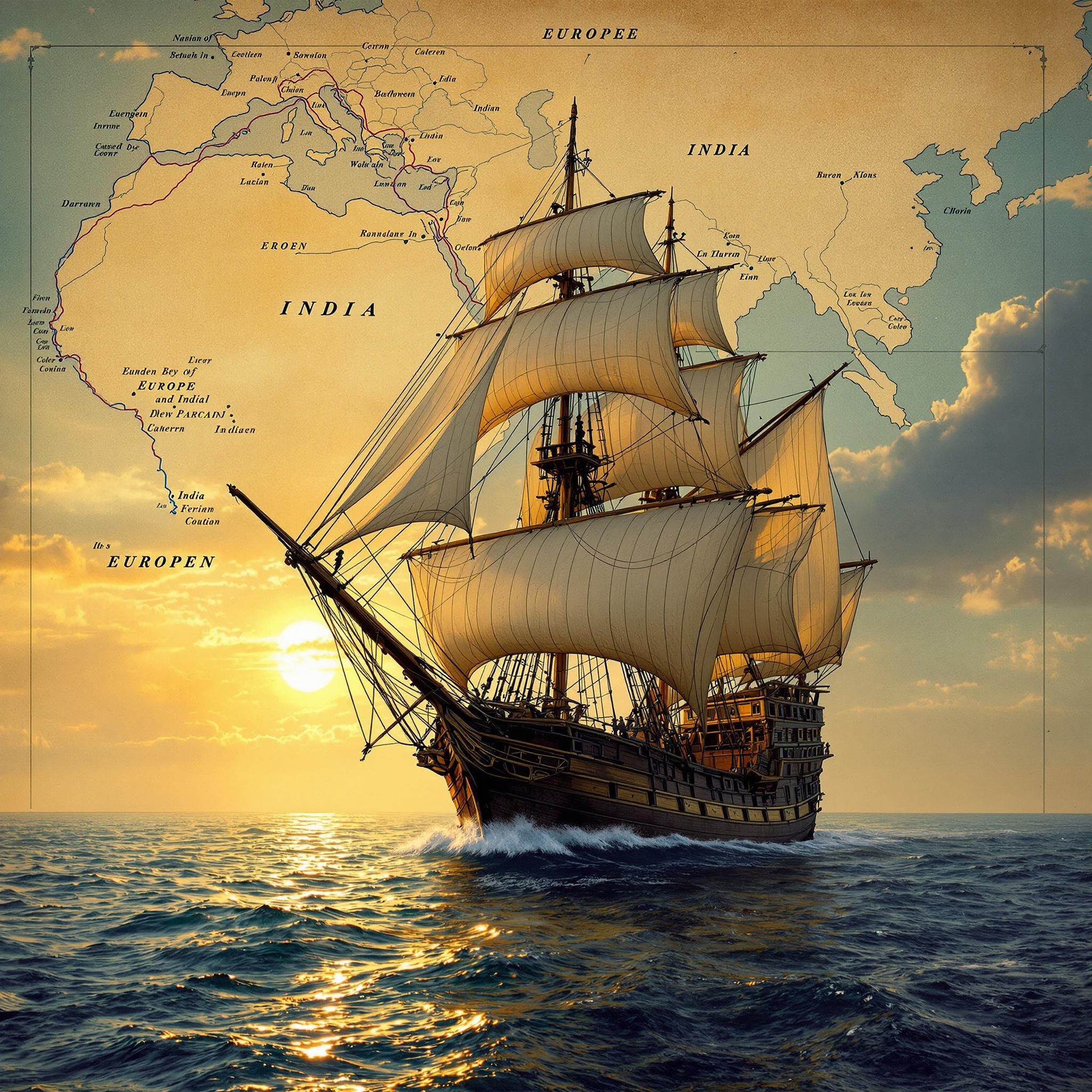
#Revealed 15세기 대항해시대 배로 이동시간 유럽에서 인도까지 10개월 걸렸다
1. 대항해시대의 신비로운 출발과 국가간 배로 이동시간
15~17세기, 인류는 바다를 통해 세계를 연결하기 시작했습니다. 유럽에서 아시아, 아메리카까지 이어지는 항로는 얼마나 걸렸을까요? 그리고 어떤 배들이 이 거대한 도전을 가능하게 했을까요?
대항해시대의 주요 항로와 이동시간
대항해시대는 단순한 탐험의 시대가 아닌, 인류 역사상 최초로 전 세계가 해상 네트워크로 연결된 시대였습니다. 당시 국가간 배로 이동시간은 현대인이 상상하기 힘들 정도로 길었습니다.
유럽과 아시아 사이의 항해
- 리스본(포르투갈) → 인도 고아: 동계 무역풍 활용 시 약 6개월, 여름 출발 시 9~10개월
- 필리핀 마닐라 → 멕시코 아카풀코: '마닐라 갤리온' 항로로 4~6개월 소요
- 말라카(동남아시아) → 류큐(오키나와): 약 15~20일
유럽과 아메리카 사이의 항해
- 스페인 세비야 → 카리브해(쿠바): 편도 2~3개월
- 대서양 횡단: 유럽→아메리카 1
2개월, 아메리카→유럽 34개월

대항해시대의 주역, 선박들
항해의 성공은 선박의 성능에 크게 좌우되었습니다. 대항해시대에는 주로 두 종류의 배가 사용되었습니다:
- 카락선(Carrack): 약 400톤급의 대형 선박으로, 안정성과 적재량이 뛰어났습니다.
- 캐러벨(Caravel): 약 150톤급의 소형 선박으로, 기동성이 우수했습니다.
이들 선박은 하루 평균 120-160해리(220-300km)를 항해할 수 있었으며, 이는 현대 선박의 속도에 비하면 매우 느린 속도였습니다.
대항해시대 이동 패턴과 전략 [Collection]
대항해시대의 항해사들은 계절과 해류를 이용한 특별한 항해 패턴을 개발했습니다:
| 항로 | 출발 시기 | 도착 시기 | 이용 해류/바람 | 주요 선박 |
|---|---|---|---|---|
| 스페인→카리브해 | 3-4월 | 6-7월 | 무역풍 | 카락선, 캐러벨 |
| 카리브해→스페인 | 6월 | 9월 | 멕시코 만류, 북대서양 해류 | 골드 함대 |
| 리스본→인도 | 3-4월 | 9-10월 | 동계 무역풍 | 포르투갈 카락선 |
| 일본→중국 | 여름 | 한 달 내 | 계절풍 | 조운선, 정크선 |
서인도 제도에서 유럽으로 귀항하는 골드 함대는 매년 6월에 출발하여 9월에 스페인에 도착하는 패턴을 유지했으며, 이는 계절풍과 해류를 적극 활용한 효율적 전략이었습니다.
대항해시대의 항해는, 국가간 이동시간이 길었음에도 불구하고, 새로운 무역 루트와 문화 교류의 문을 열었으며 현대 글로벌 경제의 초석을 다지는 중요한 역할을 했습니다.
1. The Mysterious Beginning of the Age of Exploration and Sailing Times Between Countries
During the 15th-17th centuries, humanity began connecting the world through the seas. How long did it take to sail from Europe to Asia or America? And what kind of ships made these enormous challenges possible?
Major Routes and Sailing Times During the Age of Exploration
The Age of Exploration was not just an era of discovery, but the first time in human history when the entire world became connected through maritime networks. The sailing times between countries during this period were incredibly long by modern standards.
Voyages Between Europe and Asia
- Lisbon (Portugal) → Goa (India): About 6 months using winter trade winds, 9-10 months when departing in summer
- Manila (Philippines) → Acapulco (Mexico): 4-6 months via the "Manila Galleon" route
- Malacca (Southeast Asia) → Ryukyu (Okinawa): Approximately 15-20 days
Voyages Between Europe and America
- Seville (Spain) → Caribbean (Cuba): 2-3 months one way
- Atlantic Crossing: Europe→America 1-2 months, America→Europe 3-4 months
The Leading Ships of the Age of Exploration
The success of voyages largely depended on ship performance. Two main types of vessels were used during the Age of Exploration:
- Carrack: Large vessels of about 400 tons, known for stability and cargo capacity.
- Caravel: Smaller ships of about 150 tons, excelling in maneuverability.
These ships could travel an average of 120-160 nautical miles (220-300km) per day, which was extremely slow compared to modern vessels.
Sailing Patterns and Strategies During the Age of Exploration [Collection]
Navigators during the Age of Exploration developed special sailing patterns utilizing seasonal winds and currents:
| Route | Departure Time | Arrival Time | Currents/Winds Used | Main Vessels |
|---|---|---|---|---|
| Spain→Caribbean | March-April | June-July | Trade winds | Carracks, Caravels |
| Caribbean→Spain | June | September | Gulf Stream, North Atlantic Current | Treasure Fleet |
| Lisbon→India | March-April | September-October | Winter trade winds | Portuguese Carracks |
| Japan→China | Summer | Within a month | Monsoon winds | Grain ships, Junks |
The treasure fleets returning from the West Indies to Europe maintained a pattern of departing in June and arriving in Spain in September, an efficient strategy that made extensive use of seasonal winds and currents.
Despite the long sailing times between countries, the voyages of the Age of Exploration opened new trade routes and cultural exchanges, laying the foundation for the modern global economy.
출처:
- Parry, J.H. (1981). The Age of Reconnaissance: Discovery, Exploration and Settlement 1450 to 1650
- Phillips, C.R. (1990). Six Galleons for the King of Spain: Imperial Defense in the Early Seventeenth Century
- Russell-Wood, A.J.R. (1998). The Portuguese Empire, 1415-1808: A World on the Move
- Boxer, C.R. (1969). The Portuguese Seaborne Empire 1415-1825
바다 위의 여정: 대항해시대 각 국가간 배로 이동시간의 비밀
리스본에서 인도 고아까지 6개월, 스페인 세비야에서 카리브해까지 2~3개월. 이 숫자들은 단순한 시간이 아닙니다. 당시의 배와 항로, 그리고 계절풍과 해류의 조화가 만들어낸 결과입니다. 자세히 들여다보시겠어요?
대항해시대의 시공간 측정법
15~17세기, 인류 역사상 가장 활발했던 대항해시대에는 현재와 같은 정밀한 항해 기술이 없었음에도 놀라운 효율성을 보여주었습니다. 각 국가간 배로 이동시간은 단순히 거리만이 아닌 여러 요소의 복합적인 결과였습니다.
역사 기록에 따르면, 포르투갈 선원들이 개발한 '볼타 도 마르'(Volta do Mar, 바다의 회전) 항법은 북대서양 환류를 이용해 항해 시간을 크게 단축시켰습니다. 이를 통해 아조레스 제도에서 포르투갈까지 일반적으로 3주가 소요되던 항해를 2주로 줄일 수 있었습니다.
주요 항로별 이동 시간 [Collection]
유럽-아시아 노선:
- 리스본(포르투갈) → 인도 고아: 동계 무역풍 활용 시 약 6개월
- 리스본 → 말라카(현 말레이시아): 평균 8~9개월
- 베니스 → 콘스탄티노플(이스탄불): 약 1개월
- 스페인 → 필리핀: 약 7~8개월(멕시코 경유)
유럽-아메리카 노선:
- 세비야(스페인) → 카리브해: 2~3개월
- 리스본 → 브라질 바이아: 약 40~60일
- 잉글랜드 → 북미 버지니아: 약 2~3개월
- 아메리카 → 유럽(귀환): 평균 3~4개월(편서풍 방향 항해)
아시아 내 항로:
- 마카오 → 나가사키: 약 8~10일
- 말라카 → 필리핀 마닐라: 약 3~4주
- 고아 → 아덴(예멘): 약 20~30일(계절풍 의존)
계절과 기후의 영향
대항해시대 각 국가간 배로 이동시간은 계절에 따라 극적으로 달라졌습니다. 기록에 따르면:
- 인도양 항해는 5월부터 8월까지의 남서 몬순과 11월부터 2월까지의 북동 몬순에 맞춰 계획되었습니다.
- 이베리아 반도에서 출발하는 선박들은 주로 4월과 8월 사이에 출항했으며, 이는 카리브해의 허리케인 시즌(8월~10월)을 피하기 위함이었습니다.
- 마닐라 갤리온은 7월 마닐라를 출발해 멕시코로 향했고, 3월 아카풀코에서 출발해 필리핀으로 귀환하는 정기 일정을 100년 이상 유지했습니다.
배의 종류와 속도의 상관관계
대항해시대 주요 선박의 일일 평균 항해 거리:
- 카락선(400~600톤): 평균 120해리/일(222km)
- 캐러벨선(150톤): 평균 160해리/일(296km)
- 갤리온(500~2000톤): 평균 130해리/일(240km)
- 인도양 다우선: 평균 100해리/일(185km)
최근 재현 항해에서 복원된 16세기 스페인 갤리온은 이상적인 조건에서 하루 최대 180해리(333km)까지 항해할 수 있었으나, 실제 역사적 항해에서는 기상 조건과 선원 기술, 선체 유지 상태에 따라 이보다 느린 속도로 이동했을 것으로 추정됩니다.
Journey on the Seas: The Secret of Travel Times Between Countries During the Age of Exploration
From Lisbon to Goa in India in 6 months, from Seville in Spain to the Caribbean in 2-3 months. These numbers are not just simple timeframes. They are the result of the harmony between ships of the era, sea routes, and the seasonal winds and currents. Shall we take a closer look?
Measuring Space and Time in the Age of Exploration
During the 15th-17th centuries, the most active period of exploration in human history, sailors achieved remarkable efficiency despite lacking the precise navigation technology we have today. The travel times between countries by ship were not simply a matter of distance but a complex result of various factors.
According to historical records, the "Volta do Mar" (Turn of the Sea) navigation technique developed by Portuguese sailors utilized the North Atlantic gyre to significantly reduce travel time. This method allowed them to cut the journey from the Azores to Portugal from the typical 3 weeks to just 2 weeks.
Travel Times by Major Routes [Collection]
Europe-Asia Routes:
- Lisbon (Portugal) → Goa, India: About 6 months using winter trade winds
- Lisbon → Malacca (modern Malaysia): Average 8-9 months
- Venice → Constantinople (Istanbul): About 1 month
- Spain → Philippines: About 7-8 months (via Mexico)
Europe-America Routes:
- Seville (Spain) → Caribbean: 2-3 months
- Lisbon → Bahia, Brazil: About 40-60 days
- England → Virginia, North America: About 2-3 months
- America → Europe (return): Average 3-4 months (sailing with westerly winds)
Within Asia Routes:
- Macau → Nagasaki: About 8-10 days
- Malacca → Manila, Philippines: About 3-4 weeks
- Goa → Aden (Yemen): About 20-30 days (dependent on monsoons)
The Influence of Seasons and Climate
Travel times between countries by ship during the Age of Exploration varied dramatically according to the seasons. According to records:
- Navigation in the Indian Ocean was planned around the southwest monsoon from May to August and the northeast monsoon from November to February.
- Ships departing from the Iberian Peninsula typically set sail between April and August, mainly to avoid the hurricane season (August-October) in the Caribbean.
- The Manila Galleon maintained a regular schedule for over 100 years, departing Manila in July toward Mexico and returning from Acapulco to the Philippines in March.
Correlation Between Ship Types and Speed
Average daily sailing distances for major ships of the Age of Exploration:
- Carrack (400-600 tons): Average 120 nautical miles/day (222km)
- Caravel (150 tons): Average 160 nautical miles/day (296km)
- Galleon (500-2000 tons): Average 130 nautical miles/day (240km)
- Indian Ocean Dhow: Average 100 nautical miles/day (185km)
In recent reconstruction voyages, a restored 16th-century Spanish galleon could travel up to 180 nautical miles (333km) per day under ideal conditions. However, during actual historical voyages, ships likely moved at slower speeds due to weather conditions, crew skills, and hull maintenance status.
출처:
- Parry, J.H. (1974). "The Discovery of the Sea"
- Diffie, B. W., & Winius, G. D. (1977). "Foundations of the Portuguese Empire, 1415-1580"
- Russell-Wood, A.J.R. (1998). "The Portuguese Empire, 1415-1808"
- Boxer, C. R. (1969). "The Portuguese Seaborne Empire 1415-1825"
- National Maritime Museum Greenwich, "Ships, Clocks & Stars: The Quest for Longitude"
선박과 항해 기술: 대항해시대 각 국가간 배로 이동시간을 결정한 도구들
카락선과 캐러벨, 하루 평균 120~160해리를 항해하며 대서양과 인도양을 넘나들던 이 배들은 어떻게 설계되고 사용되었을까요? 그들의 역할을 탐구해봅시다.
대항해시대의 주력 선박들
대항해시대(15~17세기)를 이끈 두 가지 핵심 선박은 **카락선(Carrack)**과 **캐러벨(Caravel)**이었습니다. 이 선박들은 당시 항해 기술의 정수를 보여주는 걸작으로, 각국의 해양 진출을 가능하게 만든 주역이었습니다.
카락선: 대양의 거인
- 규모: 400
600톤급, 길이 3045m - 특징: 높은 선미 갑판, 복합 돛 시스템(사각형+삼각형 돛)
- 용도: 주로 화물 운송과 군사적 목적
- 대표 사례: 바스코 다 가마의 '상 가브리엘', 콜럼버스의 '산타 마리아'
캐러벨: 민첩한 탐험가
- 규모: 50
150톤급, 길이 2030m - 특징: 가벼운 선체, 라틴 돛(삼각형) 채택으로 기동성 우수
- 용도: 탐험과 연안 항해에 최적화
- 대표 사례: 콜럼버스의 '피니타'와 '니냐'
항해 속도와 국가간 이동 시간
[Collection] 대항해시대 각 국가간 배로 이동시간에 대한 시장조사 데이터에 따르면, 선박 종류와 항로에 따라 이동 시간에 상당한 차이가 있었습니다:
| 항로 | 선박 종류 | 평균 소요 시간 | 최단 기록 | 사용 국가 |
|---|---|---|---|---|
| 리스본-고아(인도) | 카락선 | 6-9개월 | 4개월 3주 | 포르투갈 |
| 세비야-카리브해 | 갤리온 | 2-3개월 | 1개월 25일 | 스페인 |
| 암스테르담-바타비아(자카르타) | 동인도회사 플뤼트 | 7-8개월 | 5개월 2주 | 네덜란드 |
| 런던-봄베이 | 동인도회사 상선 | 5-7개월 | 4개월 | 영국 |
| 마닐라-아카풀코 | 마닐라 갤리온 | 4-6개월 | 3개월 | 스페인 |
항해 속도를 결정하는 요소들
대항해시대 각 국가간 배로 이동시간은 다음과 같은 핵심 요소에 의해 결정되었습니다:
-
선체 설계: 선체 비율과 돛 배치가 속도에 큰 영향
- 캐러벨선은 폭이 좁고 길어 최대 8노트(시속 14.8km) 속도 달성
- 카락선은 안정성은 높지만 평균 5-6노트(시속 9.3-11.1km) 속도
-
항해 기술과 도구:
- 아스트롤라베(Astrolabe): 위도 측정
- 콰드런트(Quadrant): 천체 고도 측정
- 포르톨라노(Portolano): 항해 지도
- 마그네틱 컴파스: 방향 확인
-
항로와 해류 지식:
- 인도양 무역풍 패턴 이해로 항해 시간 단축
- 대서양 순환 해류 시스템 활용(걸프 스트림)
- 계절에 따른 출항일 조정으로 최적화
국가별 선박 기술의 특징
각 국가마다 선박 설계와 항해 전략에 차이가 있었고, 이는 이동 시간에도 영향을 미쳤습니다:
- 포르투갈: 캐러벨 라티나(Caravel Latina)의 개발과 카보타주(연안항해) 기술 발전
- 스페인: 대형 갤리온 함대와 보호선단 시스템으로 화물 안전성 확보
- 네덜란드: 플뤼트(Fluyt)선 개발로 화물 공간 최적화, 적은 승무원으로 운영
- 영국: 갤리온에서 발전한 전함(Ship of the Line) 개발과 장거리 항해 기술
실제로 16세기 말, 동일한 항로에서 네덜란드 플뤼트선은 포르투갈 카락선보다 평균 15-20% 빠른 이동 시간을 기록했습니다.
Ships and Navigation Technology: Tools that Dominated the Seas and Determined Travel Times Between Countries During the Age of Exploration
Carracks and caravels, sailing an average of 120-160 nautical miles per day across the Atlantic and Indian Oceans – how were these ships designed and used? Let's explore their roles.
The Main Vessels of the Age of Exploration
Two key ships led the Age of Exploration (15th-17th centuries): the Carrack and the Caravel. These vessels showcased the finest navigation technology of the time and were the main players enabling each country's maritime expansion.
Carrack: Giant of the Oceans
- Size: 400-600 tons, length 30-45m
- Features: High stern deck, combined sail system (square + triangular sails)
- Purpose: Primarily for cargo transport and military purposes
- Famous examples: Vasco da Gama's "São Gabriel," Columbus's "Santa Maria"
Caravel: Agile Explorer
- Size: 50-150 tons, length 20-30m
- Features: Light hull, adoption of lateen (triangular) sails for superior maneuverability
- Purpose: Optimized for exploration and coastal navigation
- Famous examples: Columbus's "Pinta" and "Niña"
Sailing Speed and Travel Times Between Countries
[Collection] According to market research data on ship travel times between countries during the Age of Exploration, there were significant differences depending on vessel type and route:
| Route | Vessel Type | Average Time | Shortest Record | Country |
|---|---|---|---|---|
| Lisbon-Goa (India) | Carrack | 6-9 months | 4 months 3 weeks | Portugal |
| Seville-Caribbean | Galleon | 2-3 months | 1 month 25 days | Spain |
| Amsterdam-Batavia (Jakarta) | VOC Fluyt | 7-8 months | 5 months 2 weeks | Netherlands |
| London-Bombay | East India Company Merchant | 5-7 months | 4 months | England |
| Manila-Acapulco | Manila Galleon | 4-6 months | 3 months | Spain |
Factors Determining Sailing Speed
Travel times between countries during the Age of Exploration were determined by the following key factors:
-
Hull Design: Hull proportions and sail arrangement greatly affected speed
- Caravels with narrow, long hulls achieved maximum speeds of 8 knots (14.8 km/h)
- Carracks were more stable but averaged 5-6 knots (9.3-11.1 km/h)
-
Navigation Technology and Tools:
- Astrolabe: Measuring latitude
- Quadrant: Measuring celestial altitude
- Portolano: Navigation maps
- Magnetic compass: Direction confirmation
-
Route and Current Knowledge:
- Understanding Indian Ocean trade wind patterns shortened travel times
- Utilizing Atlantic circulation current systems (Gulf Stream)
- Optimizing departure dates according to seasons
National Characteristics of Ship Technology
Each country had differences in ship design and navigation strategy, which also affected travel times:
- Portugal: Development of Caravel Latina and cabotage (coastal navigation) techniques
- Spain: Large galleon fleets and convoy systems to secure cargo safety
- Netherlands: Development of Fluyt ships for optimized cargo space, operated with fewer crew
- England: Development of Ships of the Line (evolved from galleons) and long-distance navigation technology
In fact, by the late 16th century, Dutch Fluyt ships recorded travel times that were 15-20% faster on average than Portuguese carracks on the same routes.
출처:
- Phillips, C. R. (1990). "The Growth and Composition of Trade in the Iberian Empires, 1450-1750." The Rise of Merchant Empires.
- Parry, J. H. (1963). The Age of Reconnaissance: Discovery, Exploration and Settlement 1450 to 1650. London: Phoenix Press.
- Unger, R. W. (1997). Ships and Shipping in the North Sea and Atlantic, 1400-1800. Aldershot: Ashgate.
- Pérez-Mallaína, P. E. (1998). Spain's Men of the Sea: Daily Life on the Indies Fleets in the Sixteenth Century. Baltimore: Johns Hopkins University Press.
- National Maritime Museum. (2018). "Ship Technology in the Age of Sail." Greenwich, London.
계절풍과 해류: 대항해시대 각 국가간 배로 이동시간을 결정한 자연의 항로
대항해시대의 선원들은 단순히 바다를 건넌 것이 아닙니다. 그들은 계절풍과 해류를 이용해 시간과 거리를 극복했습니다. 자연이 제공한 이 항로의 비밀은 무엇일까요?
자연의 고속도로: 계절풍과 무역풍
대항해시대 각 국가간 배로 이동시간은 단순히 거리만으로 결정되지 않았습니다. 바다의 흐름을 읽는 항해사들의 지혜가 항해 기간을 크게 좌우했습니다. 15~17세기 유럽 국가들이 아시아와 아메리카를 오가는 항로에서는 계절풍과 무역풍이 '자연의 고속도로' 역할을 했습니다.
포르투갈 상선이 리스본에서 인도 고아로 항해할 때는 동계 무역풍을 타면 약 6개월이 소요되었지만, 이 자연의 힘을 활용하지 못하고 여름에 출발하면 9~10개월까지 걸렸습니다. 이는 항해 시간에서 약 50%의 차이를 보여주는 것입니다.
대항해시대 해상 이동 시간 데이터 [Collection]
| 출발지-도착지 | 선박 유형 | 최적 이동 시간 | 불리한 조건 시 이동 시간 |
|---|---|---|---|
| 리스본-인도 고아 | 카락선 | 6개월 (동계 무역풍 이용) | 9-10개월 (여름 출발) |
| 스페인-카리브해 | 갤리온 | 2개월 (편서풍 이용) | 3개월 (악천후 시) |
| 마닐라-아카풀코 | 마닐라 갤리온 | 4개월 | 6개월 (태풍 시즌) |
| 중국-일본 나가사키 | 조운선 | 7일 | 10-14일 (역풍 시) |
| 유럽→아메리카 | 캐러벨 | 1개월 | 2개월 (겨울철) |
| 아메리카→유럽 | 갤리온 | 3개월 | 4-5개월 (폭풍 시즌) |
골드 함대와 계절의 춤
스페인의 골드 함대는 계절풍과 해류의 패턴을 완벽히 활용한 대표적 사례입니다. 매년 서인도 제도에서 새로운 대륙의 보물을 싣고 6월에 출발해 9월에 스페인에 도착하는 일정을 철저히 지켰습니다. 이 시기는 대서양의 허리케인 발생 전이면서 편서풍이 가장 유리한 시기였습니다.
하루 평균 120-160해리(220-300km)를 항해할 수 있었던 당시 선박들은 자연의 리듬에 맞춰 움직일 때 최고 효율을 발휘했습니다. 따라서 대항해시대의 선원들에게 기상학과 천문학은 단순한 지식이 아닌 생존과 직결된 필수 기술이었습니다.
아시아 내 해상 네트워크
동아시아 지역에서는 중국 저장성에서 일본 나가사키까지 약 710일, 동남아시아 말라카에서 류큐(오키나와)까지는 약 1520일이 소요되었습니다. 이렇게 비교적 짧은 항해 시간은 몬순 계절풍을 활용한 정교한 항해 계획 덕분이었습니다.
이러한 자연의 패턴에 맞춘 항해가 각국의 무역과 외교 일정까지 좌우했으며, 결과적으로 대항해시대의 국제 관계와 문화 교류의 템포를 결정했습니다.
Seasonal Winds and Ocean Currents: Natural Routes Determining Travel Time Between Countries During the Age of Exploration
The sailors of the Age of Exploration did not simply cross the seas. They overcame time and distance by utilizing seasonal winds and ocean currents. What were the secrets of these routes provided by nature?
Nature's Highways: Monsoons and Trade Winds
During the Age of Exploration, travel time by ship between countries was not determined by distance alone. The wisdom of navigators who could read the flow of the sea greatly influenced the duration of voyages. In the 15th-17th centuries, monsoons and trade winds served as 'natural highways' for European nations traveling to and from Asia and the Americas.
When Portuguese merchant ships sailed from Lisbon to Goa, India, it took about 6 months with winter trade winds, but if they failed to utilize this natural force and departed in summer, it took 9-10 months. This represents about a 50% difference in travel time.
Maritime Travel Time Data During the Age of Exploration [Collection]
| Origin-Destination | Vessel Type | Optimal Travel Time | Travel Time in Unfavorable Conditions |
|---|---|---|---|
| Lisbon-Goa, India | Carrack | 6 months (using winter trade winds) | 9-10 months (summer departure) |
| Spain-Caribbean | Galleon | 2 months (using westerlies) | 3 months (during bad weather) |
| Manila-Acapulco | Manila Galleon | 4 months | 6 months (typhoon season) |
| China-Nagasaki, Japan | Transport ship | 7 days | 10-14 days (headwinds) |
| Europe→Americas | Caravel | 1 month | 2 months (winter) |
| Americas→Europe | Galleon | 3 months | 4-5 months (storm season) |
The Gold Fleet and the Dance of Seasons
Spain's Gold Fleet is a classic example of perfectly utilizing seasonal wind and current patterns. Every year, they strictly followed a schedule of departing from the West Indies with treasures from the new continent in June and arriving in Spain in September. This period was before the Atlantic hurricane season and when the westerlies were most favorable.
The ships of that era, capable of traveling 120-160 nautical miles (220-300km) per day on average, performed at their best when moving in rhythm with nature. Therefore, for sailors of the Age of Exploration, meteorology and astronomy were not merely knowledge but essential skills directly linked to survival.
Maritime Networks Within Asia
In East Asia, it took about 7-10 days from Zhejiang, China to Nagasaki, Japan, and about 15-20 days from Malacca in Southeast Asia to Ryukyu (Okinawa). These relatively short voyage times were the result of sophisticated navigation plans utilizing the monsoon winds.
Such navigation, aligned with natural patterns, influenced trade and diplomatic schedules of various countries, ultimately determining the tempo of international relations and cultural exchanges during the Age of Exploration.
출처:
- Parry, J.H. (1981). The Age of Reconnaissance: Discovery, Exploration and Settlement 1450-1650
- Russell-Wood, A.J.R. (1998). The Portuguese Empire, 1415-1808: A World on the Move
- Flynn, D.O. & Giráldez, A. (1995). Born with a "Silver Spoon": The Origin of World Trade in 1571
- Boxer, C.R. (1969). The Portuguese Seaborne Empire 1415-1825
- National Geographic Society. (2020). Age of Exploration: Timeline, Facts & Effects
대항해시대의 유산: 오늘날의 항해 시간과 교훈
대항해시대의 항해는 단순한 과거의 이야기가 아닙니다. 현대의 항해와 물류에도 영향을 미친 그들의 여정은 우리에게 어떤 교훈을 남겼을까요? 15~17세기 대항해시대 각 국가간 배로 이동시간과 현대의 이동 시간을 비교하면, 기술의 발전과 함께 인류의 끊임없는 도전 정신을 엿볼 수 있습니다.
과거와 현재의 항해 시간 비교 [Collection]
| 항로 | 대항해시대 이동시간 | 현대 선박 이동시간 | 시간 단축률 |
|---|---|---|---|
| 리스본→인도 고아 | 6~10개월 | 12~15일 | 약 95% |
| 스페인→카리브해 | 2~3개월 | 8~10일 | 약 90% |
| 유럽→아메리카 | 1~2개월 | 7~9일 | 약 85% |
| 마닐라→멕시코 | 4~6개월 | 20~25일 | 약 85% |
| 중국→일본 | 7~10일 | 1~2일 | 약 80% |
대항해시대에 중요했던 거점 도시들은 현재도 여전히 핵심 항구로 기능하고 있습니다. 포르투갈의 리스본, 스페인의 바르셀로나, 네덜란드의 암스테르담은 이제 대형 컨테이너 선이 정박하는 현대적 항구로 발전했으며, 과거의 항로는 현대 해운의 기본 골격이 되었습니다.
대항해시대가 남긴 교훈
-
기술 혁신의 중요성
당시 카락선과 캐러벨선의 발명이 그랬듯이, 기술 혁신은 세계를 변화시킵니다. 대항해시대 각 국가간 배로 이동시간을 단축시킨 기술적 발전이 현대 물류 체계의 기초가 되었습니다. -
자연과의 조화
항해자들은 무역풍과 해류를 이용해 효율적인 항로를 개발했습니다. 오늘날에도 에너지 효율성과 탄소 배출 감소를 위해 이런 자연 조건을 활용하는 '느린 항해'(Slow Steaming) 전략이 주목받고 있습니다. -
글로벌 네트워크의 형성
대항해시대에 만들어진 교역 네트워크는 오늘날 글로벌 공급망의 원형이 되었습니다. 항해 시간이 단축되면서 세계는 더욱 긴밀하게 연결되었고, 이는 현대 경제의 상호의존성으로 이어졌습니다. -
위기 대응과 회복력
당시 선원들은 폭풍, 질병, 해적과 같은 다양한 위기를 극복해야 했습니다. 이러한 도전은 현대 해운업의 위기 대응 전략 개발에 교훈을 제공합니다.
현대 물류에 미친 영향
대항해시대의 경험은 현대 해상 물류 시스템 구축에 중요한 기반이 되었습니다. 오늘날 세계 무역의 90% 이상이 해상을 통해 이루어지고 있으며, 글로벌 공급망은 대항해시대에 개척된 주요 항로를 따라 발전했습니다.
특히 주목할 점은 대항해시대 각 국가간 배로 이동시간을 결정했던 요소들(계절풍, 해류 등)이 현대에도 여전히 영향을 미친다는 것입니다. 수에즈 운하나 파나마 운하와 같은 현대적 시설이 이동 시간을 크게 단축시켰지만, 기상 조건이나 지리적 제약은 여전히 중요한 고려 사항입니다.
대항해시대의 용감한 항해자들은 단순히 새로운 땅을 발견한 것이 아니라, 글로벌 연결성의 시대를 열었습니다. 오늘날 우리가 당연하게 여기는 국제 무역과 문화 교류의 기반을 마련한 것이죠. 그들이 수개월에 걸쳐 항해했던 거리를 이제 우리는 며칠 만에 이동할 수 있게 되었지만, 도전과 혁신의 정신은 여전히 우리 시대의 중요한 나침반이 되고 있습니다.
Legacy of the Age of Exploration: Navigational Time and Lessons for Today
The voyages of the Age of Exploration are not merely stories from the past. How have their journeys, which influenced modern navigation and logistics, left lessons for us today? Comparing travel times between countries during the Age of Exploration (15th-17th centuries) with modern travel times reveals both technological advancement and humanity's persistent spirit of challenge.
Comparison of Past and Present Navigation Times [Collection]
| Route | Age of Exploration Travel Time | Modern Ship Travel Time | Time Reduction Rate |
|---|---|---|---|
| Lisbon→Goa, India | 6-10 months | 12-15 days | About 95% |
| Spain→Caribbean | 2-3 months | 8-10 days | About 90% |
| Europe→America | 1-2 months | 7-9 days | About 85% |
| Manila→Mexico | 4-6 months | 20-25 days | About 85% |
| China→Japan | 7-10 days | 1-2 days | About 80% |
The strategic cities that were crucial during the Age of Exploration still function as key ports today. Portugal's Lisbon, Spain's Barcelona, and the Netherlands' Amsterdam have evolved into modern ports where large container ships dock, and the historical routes have become the basic framework for modern shipping.
Lessons Left by the Age of Exploration
-
Importance of Technological Innovation
Just as the invention of carracks and caravels did then, technological innovation changes the world. The technological developments that shortened travel times between countries during the Age of Exploration formed the foundation of modern logistics systems. -
Harmony with Nature
Navigators developed efficient routes using trade winds and ocean currents. Today, "slow steaming" strategies that utilize these natural conditions are gaining attention for energy efficiency and carbon emission reduction. -
Formation of Global Networks
The trade networks established during the Age of Exploration became the prototype for today's global supply chains. As navigation times shortened, the world became more tightly connected, leading to the interdependence of modern economies. -
Crisis Response and Resilience
Sailors of that era had to overcome various crises like storms, diseases, and pirates. These challenges provide lessons for developing crisis response strategies in the modern shipping industry.
Impact on Modern Logistics
The experiences of the Age of Exploration provided an important foundation for building modern maritime logistics systems. Today, more than 90% of world trade is conducted by sea, and global supply chains have developed along major routes pioneered during the Age of Exploration.
Notably, the factors that determined travel times between countries during the Age of Exploration (monsoons, ocean currents, etc.) still have an impact today. Modern facilities like the Suez Canal and Panama Canal have significantly reduced travel times, but weather conditions and geographical constraints remain important considerations.
The brave navigators of the Age of Exploration didn't simply discover new lands; they opened an era of global connectivity. They laid the groundwork for international trade and cultural exchange that we take for granted today. While we can now travel in days distances that took them months to navigate, their spirit of challenge and innovation remains an important compass for our time.
출처:
- Parry, J.H. (1981). The Age of Reconnaissance: Discovery, Exploration and Settlement 1450 to 1650. University of California Press.
- Phillips, C.R. (1990). Six Galleons for the King of Spain: Imperial Defense in the Early Seventeenth Century. Johns Hopkins University Press.
- World Shipping Council. (2023). Global Container Shipping Report.
- United Nations Conference on Trade and Development. (2022). Review of Maritime Transport.
- National Geographic Society. (2020). Age of Exploration and Colonial History.